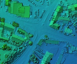
Our company provides specialized mapping services in the terrestrial and marine environment. A.S. Prote Maritime Ltd’ s experienced personnel equipped with high end optical RGB, multispectral cameras, and LIDAR payloads conducts small, medium and large scale surveys. With the appropriate geospatial processing from our side, photogrammetric flows provide high spatial resolution products, such as orthomosaics, 2D maps, 3D models, digital surface and terrain models or point clouds.
Trust our expertise
Our UAV survey services cover the fields of area inspection, archaeology, precision agriculture, search and rescue, environment monitoring, photography and cinematography, conclusively denoting our company as an end-to-end drone data collection provider.